


Built With GNSS: A Busy Port’s First GIS
Customer Company Size
Large Corporate
Region
- America
Country
- United States
Product
- Trimble R2 Integrated GNSS System
- Trimble T10 Tablet
- Esri Collector
Tech Stack
- GNSS
- GIS
- VRS Network
Implementation Scale
- Pilot projects
Impact Metrics
- Productivity Improvements
- Digital Expertise
Technology Category
- Platform as a Service (PaaS) - Data Management Platforms
- Application Infrastructure & Middleware - Data Exchange & Integration
Applicable Industries
- Marine & Shipping
- Transportation
Applicable Functions
- Facility Management
- Logistics & Transportation
Use Cases
- Track & Trace of Assets
- Remote Asset Management
- Infrastructure Inspection
Services
- System Integration
- Software Design & Engineering Services
About The Customer
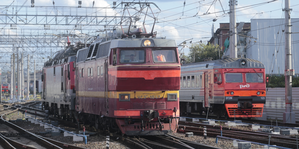
Port NOLA, located in New Orleans, Louisiana, is one of the world's busiest ports. It serves as a crucial hub at the intersection of a vast continental network of rail, rivers, and inland waterways. The port recently acquired a rail system, highlighting the need for an enterprise GIS to manage its extensive infrastructure. Port NOLA's operations are vital for both everyday activities and disaster response, necessitating accurate and up-to-date asset records. The port's infrastructure includes crane rails, gantry cranes, wharf decks, and more, all of which are essential for its operations. The port's management recognized the importance of having a modernized GIS system to streamline operations, enhance security, and improve disaster response capabilities.

The Challenge
Prior to 2016, Port NOLA had no enterprise GIS, GIS software, or dedicated GIS staff. The port relied heavily on manual and CAD drawings, engineering plans, and institutional knowledge held by employees. This posed a significant challenge, especially when employees retired or were unavailable. The acquisition of a shortline railroad added more records, complicating the situation. The port needed to map critical infrastructure like crane rails, tiedown points, and utilities to improve security and disaster response. The lack of a comprehensive GIS system made it difficult to manage these assets effectively.
The Solution
Port NOLA initiated a pilot project to develop its first enterprise GIS, utilizing Trimble technologies for precise field asset mapping. The project involved high-precision GNSS rovers paired with mobile tablets running GIS asset inventory software. The goal was to verify existing asset records and capture missing features. The mapping campaign focused on critical infrastructure like crane rails, tiedown points, and utilities. The local consulting firm, Environmental Science Services, Inc. (Es²), assisted in creating the GIS by digitizing rail infrastructure using digital orthophotos and field mapping with the Trimble R2 GNSS Rover. The project demonstrated that field mapping is a cost-effective alternative to converting legacy records, providing accurate and up-to-date asset information.
Operational Impact
Quantitative Benefit


Case Study missing?
Start adding your own!
Register with your work email and create a new case study profile for your business.
Related Case Studies.

Case Study
Airport SCADA Systems Improve Service Levels
Modern airports are one of the busiest environments on Earth and rely on process automation equipment to ensure service operators achieve their KPIs. Increasingly airport SCADA systems are being used to control all aspects of the operation and associated facilities. This is because unplanned system downtime can cost dearly, both in terms of reduced revenues and the associated loss of customer satisfaction due to inevitable travel inconvenience and disruption.

Case Study
IoT-based Fleet Intelligence Innovation
Speed to market is precious for DRVR, a rapidly growing start-up company. With a business model dependent on reliable mobile data, managers were spending their lives trying to negotiate data roaming deals with mobile network operators in different countries. And, even then, service quality was a constant concern.
Case Study
Digitize Railway with Deutsche Bahn
To reduce maintenance costs and delay-causing failures for Deutsche Bahn. They need manual measurements by a position measurement system based on custom-made MEMS sensor clusters, which allow autonomous and continuous monitoring with wireless data transmission and long battery. They were looking for data pre-processing solution in the sensor and machine learning algorithms in the cloud so as to detect critical wear.
Case Study
Cold Chain Transportation and Refrigerated Fleet Management System
1) Create a digital connected transportation solution to retrofit cold chain trailers with real-time tracking and controls. 2) Prevent multi-million dollar losses due to theft or spoilage. 3) Deliver a digital chain-of-custody solution for door to door load monitoring and security. 4) Provide a trusted multi-fleet solution in a single application with granular data and access controls.

Case Study
Vehicle Fleet Analytics
Organizations frequently implement a maintenance strategy for their fleets of vehicles using a combination of time and usage based maintenance schedules. While effective as a whole, time and usage based schedules do not take into account driving patterns, environmental factors, and sensors currently deployed within the vehicle measuring crank voltage, ignition voltage, and acceleration, all of which have a significant influence on the overall health of the vehicle.In a typical fleet, a large percentage of road calls are related to electrical failure, with battery failure being a common cause. Battery failures result in unmet service agreement levels and costly re-adjustment of scheduled to provide replacement vehicles. To reduce the impact of unplanned maintenance, the transportation logistics company was interested in a trial of C3 Vehicle Fleet Analytics.

Case Study
3M Gains Real-Time Insight with Cloud Solution
The company has a long track record of innovative technology solutions. For example, 3M helps its customers optimize parking operations by automating fee collection and other processes. To improve support for this rapidly expanding segment, 3M needed to automate its own data collection and reporting. The company had recently purchased the assets of parking, tolling, and automatic license plate reader businesses, and required better insight into these acquisitions. Chad Reed, Global Business Manager for 3M Parking Systems, says, “With thousands of installations across the world, we couldn’t keep track of our software and hardware deployments, which made it difficult to understand our market penetration.” 3M wanted a tracking application that sales staff could use to get real-time information about the type and location of 3M products in parking lots and garages. So that it could be used on-site with potential customers, the solution would have to provide access to data anytime, anywhere, and from an array of mobile devices. Jason Fox, Mobile Application Architect at 3M, upped the ante by volunteering to deliver the new app in one weekend. For Fox and his team, these requirements meant turning to the cloud instead of an on-premises datacenter. “My first thought was to go directly to the cloud because we needed to provide access not only to our salespeople, but to resellers who didn’t have access to our internal network,” says Fox. “The cloud just seemed like a logical choice.”
