


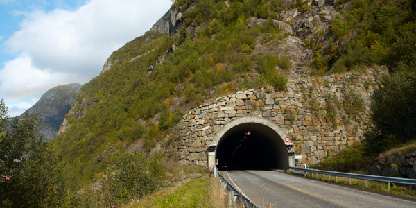
Innovative Surveying Techniques for Riverside Drive Parking Deck in Elgin, Illinois
Customer Company Size
Mid-size Company
Region
- America
Country
- United States
Product
- Trimble GX 3D Scanner
- Trimble TSC2 Controller
- Trimble PointScape™ software
- Trimble VX™ Spatial Station
- Trimble VRS™ network
Tech Stack
- GNSS receivers
- 3D Scanning Technology
- Survey Workflow Features
Implementation Scale
- Departmental Deployment
Impact Metrics
- Digital Expertise
- Innovation Output
- Productivity Improvements
Technology Category
- Analytics & Modeling - Real Time Analytics
- Networks & Connectivity - Global Navigation Satellite System (GNSS)
- Functional Applications - Remote Monitoring & Control Systems
Applicable Industries
- Construction & Infrastructure
- Cities & Municipalities
Applicable Functions
- Facility Management
- Quality Assurance
Use Cases
- Structural Health Monitoring
- Infrastructure Inspection
- Remote Asset Management
Services
- Software Design & Engineering Services
- System Integration
About The Customer
V3 Companies, Ltd. is a multidisciplined consulting firm known for its innovative approach to complex engineering and surveying projects. The company was tasked with analyzing the Riverside Drive Parking Deck in Elgin, Illinois, a structure built in the mid-1960s and situated over the Fox River. V3 Companies specializes in providing comprehensive solutions for infrastructure projects, leveraging advanced technology and expertise in surveying and engineering. The firm is recognized for its ability to adapt to challenging environments and deliver precise data for infrastructure analysis and renewal projects. With a focus on utilizing cutting-edge technology, V3 Companies aims to provide efficient and effective solutions for aging infrastructure, ensuring safety and sustainability in urban development.

The Challenge
The Riverside Drive Parking Deck in Elgin, Illinois, built in the mid-1960s, is a large structure approximately 1,000-ft long by 60-ft wide, situated over the Fox River. The deck is supported by hundreds of concrete piles reinforced with high-tensile steel wire, which has started to rust over time. In 2003, a significant piece of the deck fell into the river, prompting Elgin officials to analyze the deck for potential reuse in ongoing waterfront renewal projects. This required innovative survey work under the deck and in the Fox River, a task assigned to V3 Companies, Ltd., a multidisciplined consulting firm. The challenge was to conduct a thorough survey in a shallow river environment, where traditional survey setups could not be revisited, and to gather comprehensive data for analysis.
The Solution
To address the challenge of surveying the Riverside Drive Parking Deck, V3 Companies employed a range of advanced technologies and innovative techniques. The team, led by V3 Survey Technology Manager Grant Van Bortel and V3 Crew Chief Steve Arnold, utilized a Trimble GX 3D Scanner, laptops, and heavy-duty marine batteries to conduct the survey. The scanner's survey workflow features allowed for efficient data collection without the need for revisiting setups, functioning similarly to a total station. The team used a rowboat as a mobile workstation, tying it to beams and piles to facilitate data collection. By employing Trimble's PointScape™ software on a ruggedized field laptop, the team could verify results in real-time, ensuring accuracy before leaving survey points. Additionally, the use of Trimble's Connected Site™ solution and the local Precision Midwest VRS Network enabled V3 to maintain a consistent data stream in a single coordinate system, integrating multiple scanners, total stations, and GNSS receivers for comprehensive data collection.
Operational Impact
Quantitative Benefit


Case Study missing?
Start adding your own!
Register with your work email and create a new case study profile for your business.
Related Case Studies.

Case Study
Turning A Stadium Into A Smart Building
Honeywell created what it called the “intelligent system” for the National Stadium in Beijing, China, turning the venue for the opening and closing events at the 2008 Summer Olympics into a “smart building.” Designed by highly controversial artist Ai Weiwei, the “Bird’s Nest” remains one of the most impressive feats of stadium architecture in the world. The 250,000 square meter structure housed more than 100,000 athletes and spectators at a time. To accommodate such capacity, China turned to Honeywell’s EBI Integrated Building Management System to create an integrated “intelligent system” for improved building security, safety and energy efficiency.
.png)
Case Study
Smart Street Light Network (Copenhagen)
Key stakeholders are taking a comprehensive approach to rethinking smart city innovation. City leaders have collaborated through partnerships involving government, research institutions and solution providers. The Copenhagen Solutions Lab is one of the leading organizations at the forefront of this movement. By bringing together manufacturers with municipal buyers, the Copenhagen Solutions Lab has catalyzed the development and deployment of next-generation smart city innovations. Copenhagen is leveraging this unique approach to accelerate the implementation of smart city solutions. One of the primary focus areas is LED street lighting.
Case Study
IoT System for Tunnel Construction
The Zenitaka Corporation ('Zenitaka') has two major business areas: its architectural business focuses on structures such as government buildings, office buildings, and commercial facilities, while its civil engineering business is targeted at structures such as tunnels, bridges and dams. Within these areas, there presented two issues that have always persisted in regard to the construction of mountain tunnels. These issues are 'improving safety" and "reducing energy consumption". Mountain tunnels construction requires a massive amount of electricity. This is because there are many kinds of electrical equipment being used day and night, including construction machinery, construction lighting, and ventilating fan. Despite this, the amount of power consumption is generally not tightly managed. In many cases, the exact amount of power consumption is only ascertained when the bill from the power company becomes available. Sometimes, corporations install demand-monitoring equipment to help curb the maximum power demanded. However, even in these cases, the devices only allow the total volume of power consumption to be ascertained, or they may issue warnings to prevent the contracted volume of power from being exceeded. In order to tackle the issue of reducing power consumption, it was first necessary to obtain an accurate breakdown of how much power was being used in each particular area. In other words, we needed to be able to visualize the amount of power being consumed. Safety, was also not being managed very rigorously. Even now, tunnel construction sites often use a 'name label' system for managing entry into the work site. Specifically, red labels with white reverse sides that bear the workers' names on both sides are displayed at the tunnel work site entrance. The workers themselves then flip the name label to the appropriate side when entering or exiting from the work site to indicate whether or not they are working inside the tunnel at any given time. If a worker forgets to flip his or her name label when entering or exiting from the tunnel, management cannot be performed effectively. In order to tackle the challenges mentioned above, Zenitaka decided to build a system that could improve the safety of tunnel construction as well as reduce the amount of power consumed. In other words, this new system would facilitate a clear picture of which workers were working in each location at the mountain tunnel construction site, as well as which processes were being carried out at those respective locations at any given time. The system would maintain the safety of all workers while also carefully controlling the electrical equipment to reduce unnecessary power consumption. Having decided on the concept, our next concern was whether there existed any kind of robust hardware that would not break down at the construction work site, that could move freely in response to changes in the working environment, and that could accurately detect workers and vehicles using radio frequency identification (RFID). Given that this system would involve many components that were new to Zenitaka, we decided to enlist the cooperation of E.I.Sol Co., Ltd. ('E.I.Sol') as our joint development partner, as they had provided us with a highly practical proposal.
Case Study
Buoy Status Monitoring with LoRa
The Netherlands are well-known for their inland waterways, canals, sluices and of course port activities. The Dutch Ministry of Infrastructure indicates that there are thousands of buoys and fixed items in and near water environments that would profit from IoT monitoring. One of the problems with buoys for example, is that they get hit by ships and the anchor cable breaks. Without connectivity, it takes quite some time to find out that something has happened with that buoy. Not to mention the costs of renting a boat to go to the buoy to fix it. Another important issue, is that there is no real-time monitoring of the buoys at this moment. Only by physically visiting the object on the water, one gains insight in its status.

Case Study
Barcelona Case Study
Barcelona’s heavy traffic and its associated high levels of pollution were the primary factors that motivated some companies and universities to work on strategies for improving traffic in the city centre. Bitcarrier is one of the technologies involved in the In4Mo Project, whose main objective is to develop the applications that form the core of smart mobility, one of the fundamental pillars of the smart city concept.
