


Precise Positioning Provides “Superpower” Efficiency and Accuracy in Agricultural Research
Customer Company Size
Startup
Region
- America
Country
- United States
Product
- Trimble CenterPoint RTX Correction Service
- Trimble R2 GNSS Receiver
- Trimble TSC3 Controller
- Trimble Access Software
Tech Stack
- GNSS Positioning
- Aerial Imaging
- UAV Technology
Implementation Scale
- Enterprise-wide Deployment
Impact Metrics
- Productivity Improvements
- Digital Expertise
Technology Category
- Analytics & Modeling - Real Time Analytics
- Networks & Connectivity - Global Navigation Satellite System (GNSS)
- Functional Applications - Remote Monitoring & Control Systems
Applicable Industries
- Agriculture
Applicable Functions
- Field Services
- Quality Assurance
Use Cases
- Farm Monitoring & Precision Farming
- Predictive Maintenance
- Remote Asset Management
Services
- Software Design & Engineering Services
- System Integration
About The Customer
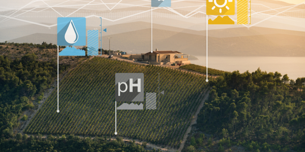
Precision Silver is a Florida-based startup company that provides specialized services for the agriculture industry. The company focuses on automated ratings for agricultural research, offering plot- and plant-level assessments on test sites across North America. Their clients include some of the world's largest agrochemical companies. Precision Silver aims to enhance the productivity and accuracy of agricultural research by replacing traditional manual evaluations with advanced aerial imagery and specialized software. The company uses customized UAVs to obtain high-resolution imagery over entire sites in a short amount of time, significantly reducing the time and effort required for data collection.

The Challenge
Agrochemical companies need to conduct ongoing research to develop and improve their products, which involves measuring the performance of crops treated with new additives. Traditionally, this task was performed manually by technicians in the field, examining individual plants using measuring sticks and clipboards. This process is tedious and requires skilled scientists to spend hours in the field collecting data, which could be better spent on analysis and interpretation. The challenge is to replace these in-field evaluations with a more efficient and accurate method that can provide high-resolution imagery and industry-standard ratings on crop performance.
The Solution
Precision Silver utilizes a Trimble solution that includes the Trimble CenterPoint RTX Correction Service, Trimble R2 GNSS Receiver, Trimble TSC3 Controller, and Trimble Access Software to provide precise positioning and simple workflows for aerial imaging and analysis. The solution allows for the establishment of survey-grade accuracy on control marks, even in remote locations where RTK or VRS is not practical. The Trimble CenterPoint RTX provides accuracy better than 2 cm horizontal and 5 cm vertical, enabling field operators to see real-time accuracy of their GNSS positions. This system allows for high-resolution images, up to 1 mm per pixel, ensuring accurate georeferencing and reliable ratings over the season. The simplicity of the Trimble solution enables local operators, who are often skilled agricultural scientists without a background in GNSS positioning, to quickly establish accurate control and focus on crop assessment.
Operational Impact
Quantitative Benefit


Case Study missing?
Start adding your own!
Register with your work email and create a new case study profile for your business.
Related Case Studies.
Case Study
Intelligent Farming with ThingWorx Analytics
Z Farms was facing three challenges: costly irrigation systems with water as a limited resource, narrow optimal ranges of soil moisture for growth with difficult maintenance and farm operators could not simply turn on irrigation systems like a faucet.

Case Study
Greenhouse Intelligent Monitoring and Control Solution
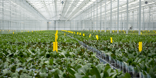
Farming Orchids is the most successful form of precision farming in Taiwan, and also the most exported flower. Orchids need a specific temperature and humidity conditions to grow and bloom, and its flowering time may not be in line with market demands, so the price collapses when there is overproduction. Therefore, some farmers began to import automated greenhouse control systems for breeding and forcing, which not only improves quality, but also effectively controls the production period and yield to ensure revenue. In 2012, an orchid farmer built a Forcing Greenhouse of about 200 pings (approximately 661 Square Meters) in Tainan, Taiwan. The system integrator adopted Advantech’s APAX-5000 series programmable automation controllers to build the control platform, coupled with Advantech WebAccess HMI/SCADA software, to achieve cloud monitoring. The staff of the orchid field can monitor important data anytime via smart phone, iPad, and other handheld devices, and control the growth and flowering conditions. System requirements: In the past, most environmental control systems of orchid greenhouses in Taiwan used PLCs (Programmable Logic Controller) with poorscalability and control, and could not be connected to the Internet formonitoring from the cloud. For advanced database analysis and networking capability, the PC platform must be adopted. Therefore, PAC Systems (Programmable Automation Controller) with both PLC programming capabilities andPC functions is a better choice.The environmental control of the Orchid greenhouse switches on and off devices like fan, shade net, cooling/heat pump, liquid flow control, water-cooling wall etc. It is controlled by a control panel of electric controllers, and is driven by a motor, to adjust the greenhouse temperature, humidity, and other environmental conditions to the set parameters.

Case Study
Precision beekeeping with wireless temperature monitoring
Honeybees are insects of large economic value and provide a vital service to agriculture by pollinating a variety of crops. In addition, bees provide us with valuable products such as honey, beeswax, propolis, bee venom, etc. Monitoring of honeybee colony health, population, productivity, and environmental conditions affecting the colony health have always been exceedingly difficult tasks in apiculture. Research has shown that even small deviations (by more than 2°C) from the optimal temperatures have a significant influence on the development of the brood and the health of adult bees.
Case Study
Enabling Internet of Things Innovation in Agriculture
DigiBale, wanted to apply technology know-how and IP from implementations successfully to more agriculture sectors including cotton, forestry, sugarcane and cattle. However, farmers and growers still have worries about the connected technology.
