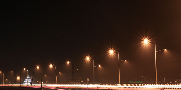
Auckland Motorway Alliance Enhances Road Management with GPS Technology
公司规模
Large Corporate
地区
- Pacific
国家
- New Zealand
产品
- Juno SB handheld
- GPS Pathfinder Office software
- TerraSync software
技术栈
- GPS Technology
- Geographic Information Systems (GIS)
实施规模
- Departmental Deployment
影响指标
- Productivity Improvements
- Cost Savings
技术
- 分析与建模 - 实时分析
- 功能应用 - 远程监控系统
适用行业
- 运输
- 城市与自治市
适用功能
- 维护
- 商业运营
用例
- 资产健康管理 (AHM)
- 远程资产管理
- 预测性维护
服务
- 系统集成
- 软件设计与工程服务
关于客户
The Auckland Motorway Alliance (AMA) is a government entity formed by the New Zealand Transport Agency in 2008. It is a collaboration of businesses, consultants, and transportation experts responsible for managing Auckland’s motorway network, which spans 186 miles. The AMA oversees various tasks, including highway repairs, environmental management, and asset maintenance. With a focus on efficiency and cost-effectiveness, the AMA aims to ensure safe and quick travel for motorway users while managing its operations within a budget funded by tax dollars. The organization is committed to environmental stewardship and seeks to improve its asset management processes to achieve its goals.

挑战
The Auckland Motorway Alliance (AMA) was tasked with managing Auckland’s extensive motorway network, which included maintaining roads, managing vegetation, and ensuring environmental compliance. The existing processes for asset management, particularly for vegetation, were outdated and inefficient, relying heavily on manual data collection and paper-based systems. This led to inaccuracies, human errors, and significant time consumption. The AMA needed a more efficient, accurate, and cost-effective solution to manage its assets and improve operational efficiency.
解决方案
To address the inefficiencies in asset management, the AMA collaborated with Trimble to implement a GPS-based solution. Trimble recommended the Juno SB handheld, a compact field computer with integrated GPS, camera, and voice recorder capabilities. This device provided real-time or post-processed positioning accuracy of two to five meters. The AMA used Trimble’s GPS Pathfinder Office software to create a data dictionary and set up custom attributes for efficient data collection using TerraSync software on the Juno SB handheld. The GIS team also acquired aerial imaging and created electronic maps to facilitate field data collection. This new system allowed ecologists to collect accurate vegetation data, which was then processed and integrated into the enterprise GIS for planning and budgeting purposes.
运营影响
数量效益


Case Study missing?
Start adding your own!
Register with your work email and create a new case study profile for your business.
相关案例.

Case Study
Turning A Stadium Into A Smart Building
Honeywell created what it called the “intelligent system” for the National Stadium in Beijing, China, turning the venue for the opening and closing events at the 2008 Summer Olympics into a “smart building.” Designed by highly controversial artist Ai Weiwei, the “Bird’s Nest” remains one of the most impressive feats of stadium architecture in the world. The 250,000 square meter structure housed more than 100,000 athletes and spectators at a time. To accommodate such capacity, China turned to Honeywell’s EBI Integrated Building Management System to create an integrated “intelligent system” for improved building security, safety and energy efficiency.
.png)
Case Study
Smart Street Light Network (Copenhagen)
Key stakeholders are taking a comprehensive approach to rethinking smart city innovation. City leaders have collaborated through partnerships involving government, research institutions and solution providers. The Copenhagen Solutions Lab is one of the leading organizations at the forefront of this movement. By bringing together manufacturers with municipal buyers, the Copenhagen Solutions Lab has catalyzed the development and deployment of next-generation smart city innovations. Copenhagen is leveraging this unique approach to accelerate the implementation of smart city solutions. One of the primary focus areas is LED street lighting.
Case Study
Airport SCADA Systems Improve Service Levels
Modern airports are one of the busiest environments on Earth and rely on process automation equipment to ensure service operators achieve their KPIs. Increasingly airport SCADA systems are being used to control all aspects of the operation and associated facilities. This is because unplanned system downtime can cost dearly, both in terms of reduced revenues and the associated loss of customer satisfaction due to inevitable travel inconvenience and disruption.

Case Study
IoT-based Fleet Intelligence Innovation
Speed to market is precious for DRVR, a rapidly growing start-up company. With a business model dependent on reliable mobile data, managers were spending their lives trying to negotiate data roaming deals with mobile network operators in different countries. And, even then, service quality was a constant concern.

Case Study
Buoy Status Monitoring with LoRa
The Netherlands are well-known for their inland waterways, canals, sluices and of course port activities. The Dutch Ministry of Infrastructure indicates that there are thousands of buoys and fixed items in and near water environments that would profit from IoT monitoring. One of the problems with buoys for example, is that they get hit by ships and the anchor cable breaks. Without connectivity, it takes quite some time to find out that something has happened with that buoy. Not to mention the costs of renting a boat to go to the buoy to fix it. Another important issue, is that there is no real-time monitoring of the buoys at this moment. Only by physically visiting the object on the water, one gains insight in its status.